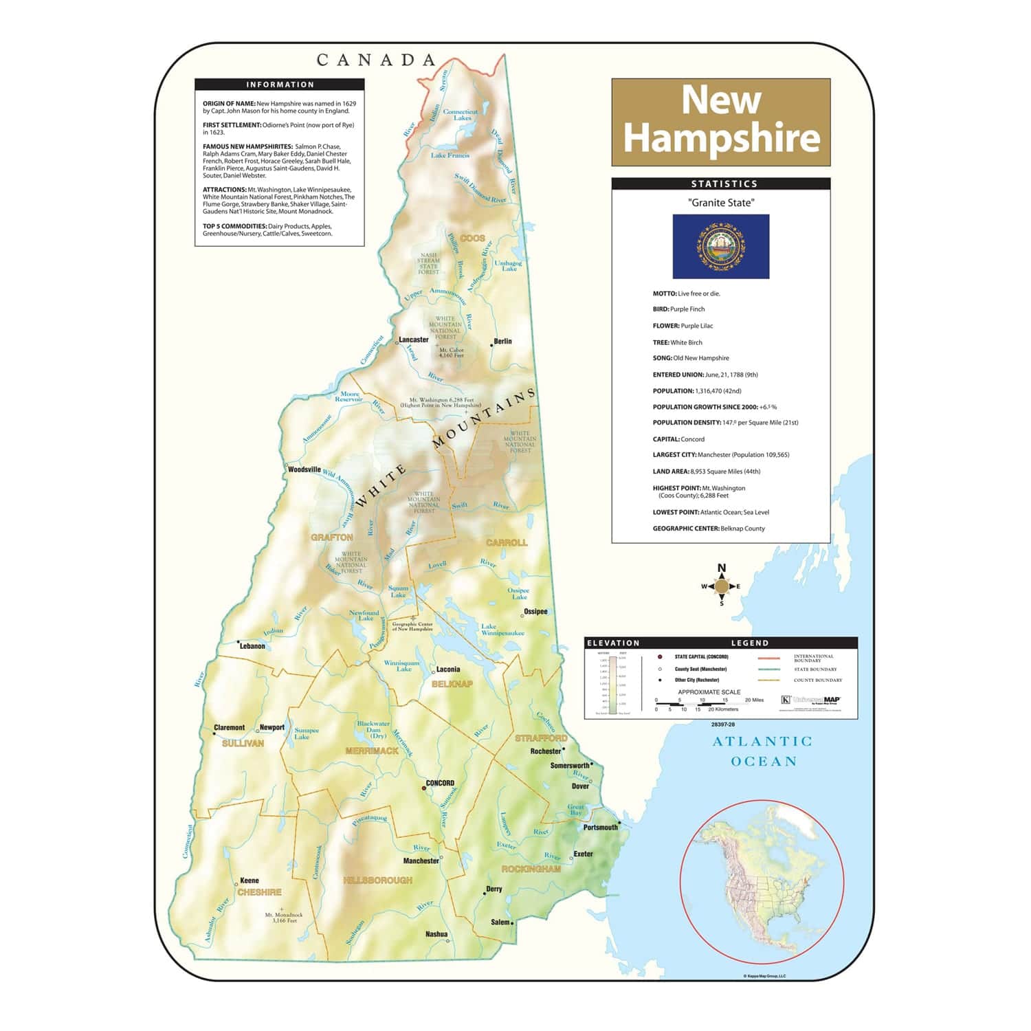
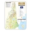
The New Hampshire Map measures 28-in. by 38-in. and includes all state and federal highways, major waterways, military installations, state parks, major airports, state universities, cities, towns, wildlife areas, and points of interest. Special features include color-coded counties and a mileage chart between major cities. This map is indexed on the face, lithographed in eight colors and laminated, making it durable, markable, and easy to read.
New Hampshire Shaded Relief Map
$19.95
Extended Holiday Returns to January 15, 2024
- Map Coverage Type: State/State Regional
- Map Size: 28"w x 38"h
- Product Currency: Latest Edition
Description
Map Ordering
Updatedness: One question we get most frequently is how up to date are your maps? The quick answer is that the map you purchase includes the latest database updates from the manufacturer. You will be receiving the most current edition available. If this item is a historical map, the datedness is as of the intended period.
Maps on Demmand: When your order for a World, USA, State, City, County, or Regional map, the map is printed on-demand, which allows for the most current version to be made available to you. This process will typically extend the lead time to ship as shown on the checkout page by 3 to 5 weeks.
Shipping & Returns
Orders $49+ qualify for FREE Shipping within the Continental USA learn more Shop now and get 30-Days or until January 15, 2024 to return and exchange items. learn more We extend the manufacturers warranty by 1 full year at no charge. learn more
Free Shipping
Extended Holiday Returns
Free 1-Year Extended Warranty
Questions & Answers
Questions and answers of the customers
There are no questions yet. Be the first to ask a question about this product.
Reviews (0)
Be the first to review “New Hampshire Shaded Relief Map” Cancel reply
Only logged in customers who have purchased this product may write a review.
Reviews
There are no reviews yet.